
Route History
Date of introduction |
Gar |
Mon-Fri |
Sat |
Sun |
| 15.11.97 | EB |
2sd |
2sd |
-- |
SUTTON Bushey Road - Sutton Town Centre - Sutton Station - Brighton Road - Cotswold Road - Downs Road - Banstead Road South - The Warren - Woodmansterne Rd - Stanley Park Rd - Queen Mary's Avenue - Gaynesford Road - Courtenay Crescent east side - Dingwall Road - Stanley Square - Cranfield Road West - Stanley Road - Stanley Park Road - Boundary Road - Grosvenor Road - Wallington Station - Woodcote Road - Woodcote Green - Sandy Lane South - Buckingham Way - Ingleby Way - Carleton Avenue - Timberslip Drive - Foresters Drive - Mollison Drive - ROUNDSHAW Neighbourhood Centre ( Mon-Sat except evenings )
New midibus route operated by Epsom Buses
with financial backing by London Borough of Sutton
| 07.03.98 | EB |
2sd |
2sd |
-- |
SUTTON Marchalls Road - Sutton Station - Grange Road - Holland Avenue - Avenue Road - Station Road - Cotswold Road - Downs Road - Banstead Road South - The Warren - Woodmansterne Rd - Stanley Park Rd - Queen Mary's Avenue - Gaynesford Road - Courtenay Crescent east side - Dingwall Road - Stanley Square - Cranfield Road West - Stanley Road - Stanley Park Road - Boundary Road - Grosvenor Road - Wallington Station - Woodcote Road - Woodcote Green - Sandy Lane South - Buckingham Way - Ingleby Way - Carleton Avenue - Timberslip Drive - Foresters Drive - Mollison Drive - ROUNDSHAW Neighbourhood Centre ( Mon-Sat except evenings )
Withdrawn bin Sutton between Marshalls Road and Bushey Road
Diverted between Sutton and Belmont as shown above
 |
MERCEDES minibus at Roundshaw terminal - the stand being exclusive to this route
|
|---|
| 09.05.98 | EB |
5sd |
5sd |
-- |
MORDEN STATION - Morden Hall Road - Central Road - Farm Road - Faversham Road - Furness Road - St Helier - Love Lane - Forest Road - Sutton Common Road - Rose Hill - Sutton High Street - Sutton Station - Grange Road - Holland Avenue - Avenue Road - Station Road - Cotswold Road - Downs Road - Banstead Road South - The Warren - Woodmansterne Rd - Stanley Park Rd - Queen Mary's Avenue - Gaynesford Road - Courtenay Crescent east side - Dingwall Road - Stanley Square - Cranfield Road West - Stanley Road - Stanley Park Road - Boundary Road - Grosvenor Road - Wallington Station - Woodcote Road - Woodcote Green - Sandy Lane South - Buckingham Way - Ingleby Way - Carleton Avenue - Timberslip Drive - Foresters Drive - Mollison Drive - ROUNDSHAW Neighbourhood Centre ( Mon-Sat except evenings )
Extended from Sutton to Morden via withdrawn Route 421
 |
S456LGN - Fleet Number SD10 seen in Morden April 04 © John Parkin |
|---|
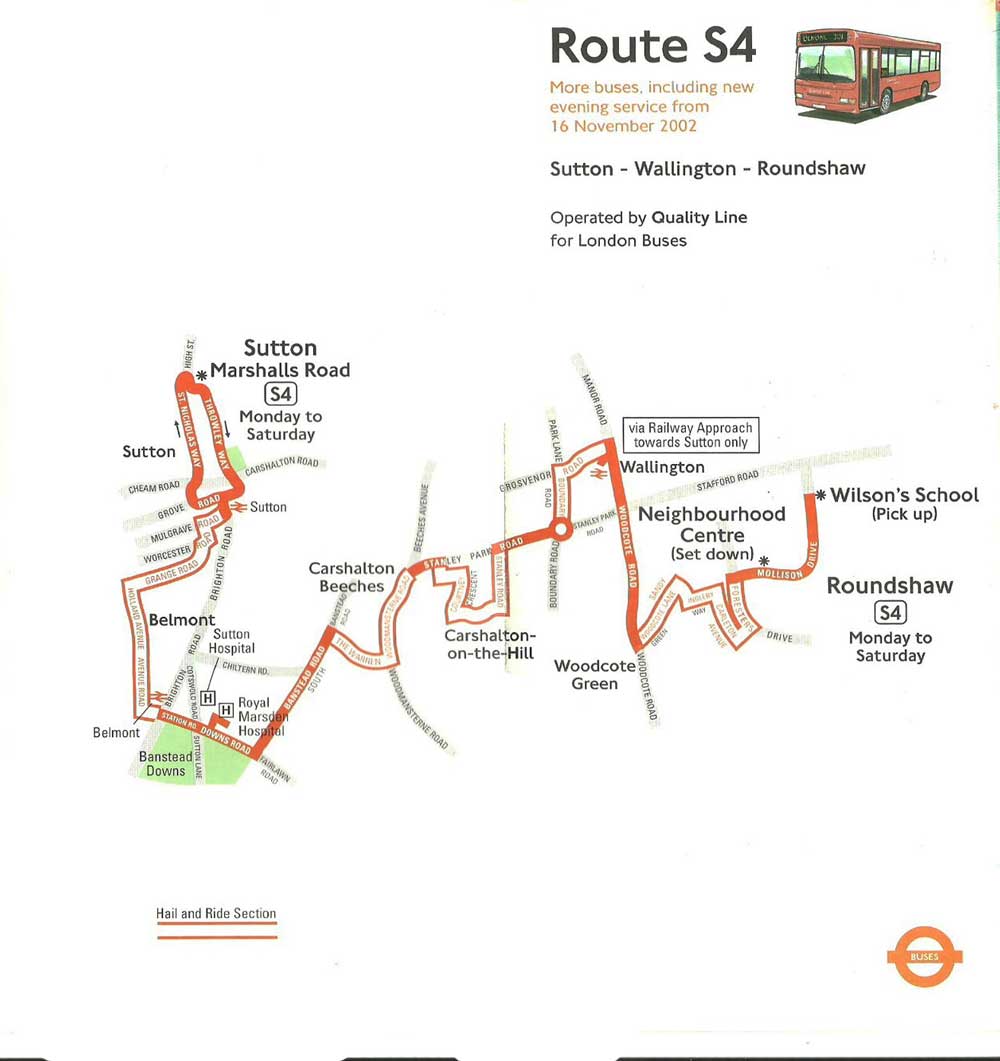
| 16.11.02 | EB41+ |
6solo |
6solo |
-- |
SUTTON Marshalls Road - Throwley Way - Carshalton Road - Chalk Pit Way - Sutton Court Road - High Street - Sutton Station - Mulgrave Road - Worcester Road - Grange Road - York Road - Holland Avenue - Avenue Road - Station Road - Brighton Road - Belmont - Downs Road - Banstead Road South - The Warren - Woodmansterne Road - Stanley Park Road - Queen Mary's Avenue - Gaynesford Road - Courtney Crescent (eastern arm) - Dingwall Road - Stanley Square - Cranfield Road West - Stanley Road - Stanley Park Road - Boundary Road - Park Lane - Grosvenor Road - Manor Road - Wallington - Woodcote Road - Woodcote Green - Sandy Lane South - Buckingham Way - Ingleby Way - Carleton Avenue - Timberslip Drive - Foresters Drive - Mollison Drive - ROUNDSHAW Neighbourhood Centre ( Mon-Sat )
Withdrawn between Sutton and Morden - this section replaced by new Route S7
Evening service introduced
 |
|---|
| 29.01.05 | EB41+ |
4solo |
4solo |
-- |
SUTTON Marshalls Road - Throwley Way - Carshalton Road - Chalk Pit Way - Sutton Court Road - High Street - Sutton Station - Mulgrave Road - Worcester Road - Grange Road - York Road - Holland Avenue - Avenue Road - Station Road - Brighton Road - Belmont Station - Downs Road - Banstead Road South - The Warren - Woodmansterne Road - Stanley Park Road - Queen Mary's Avenue - Gaynesford Road - Courtney Crescent (eastern arm) - Dingwall Road - Stanley Square - Cranfield Road West - Stanley Road - Stanley Park Road - Boundary Road - Park Lane - Grosvenor Road - Manor Road - Wallington Station - Manor Road - Woodcote Road - Woodcote Green - Sandy Lane South - Buckingham Way - Ingleby Way - Carleton Avenue - Timberslip Drive - Foresters Drive - Mollison Drive - ROUNDSHAW Wilson's School ( Mon-Sat )
Extended further along Mollison Drive in Roundshaw to Wilson's School
| 30.09.06 | EB41+ |
6solo |
6solo |
-- |
ST HELIER STATION - Green Lane - Wrythe Lane - St Helier Hospital - Wrythe Lane - Whitby Road - Duke of Edinburgh Road - Edinburgh Road - Grennell Road - Benhilton - Benhill Road - Oakhill Road - Thicket Road - Benhill Avenue - Throwley Way - Carshalton Road - Chalk Pit Way - Sutton Court Road - High Street - Sutton Station - Mulgrave Road - Worcester Road - Grange Road - York Road - Holland Avenue - Avenue Road - Station Road - Brighton Road - Belmont Station - Downs Road - Banstead Road South - The Warren - Woodmansterne Road - Stanley Park Road - Queen Mary's Avenue - Gaynesford Road - Courtney Crescent (eastern arm) - Dingwall Road - Stanley Square - Cranfield Road West - Stanley Road - Stanley Park Road - Boundary Road - Park Lane - Grosvenor Road - Manor Road - Wallington Station - Manor Road - Woodcote Road - Woodcote Green - Sandy Lane South - Buckingham Way - Ingleby Way - Carleton Avenue - Timberslip Drive - Foresters Drive - Mollison Drive - ROUNDSHAW Wilson's School ( Mon-Sat )
Extended from Sutton to St Helier
| 01.09.07 | EB41+ |
6solo |
6solo |
-- |
ST HELIER - ROUNDSHAW
Double run via Wallington Station eastbound introduced - previously had only been westbound
| 17.11.07 | EB41+ |
6solo |
6solo |
-- |
ST HELIER - ROUNDSHAW
Start of new contract
 |
Solo OP04 Wallington
|
|---|
| 17.11.12 | EB41+ |
5solo 1SE |
5solo 1SE |
-- |
ST HELIER - ROUNDSHAW
Contract extended for two years
 |
|---|
Extracted from 2013 map drawn by Mike Harris |
| 15.11.14 | BC181+ |
6SE |
6SE |
-- |
Contract reassigned |
ST HELIER - ROUNDSHAW
New contract
 |
8206 Sutton © Mark McWalter |
| 05.12.20 | BC181+ |
6SE |
5SE |
-- |
ST HELIER - ROUNDSHAW
Contract renewal
 |
S4 don't often use those newer MMCs either they tend to stay on 367 © Ryan Fielding |
| 01.03.23 | BC181+ |
6SE |
5SE |
-- |
 |
Abellio purchased by Transport UK |
ST HELIER - ROUNDSHAW
New operator
| 02.03.24 | BC181+ |
10SE |
10SE |
7SE |
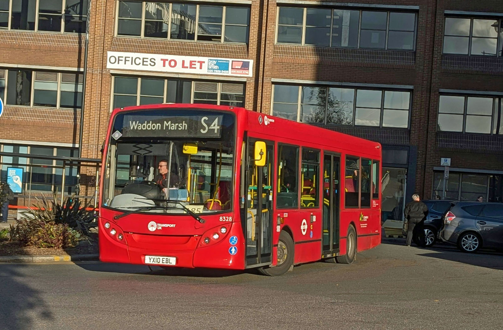
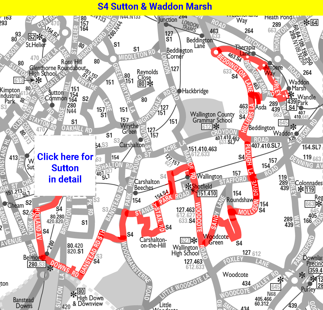
SUTTON - WADDON MARSH Tram Stop
Route S4 extended from Roundshaw to Waddon Marsh, Sainsbury's replacing route 455 via Plough Lane, Croydon Road, Beddington The Plough, Hilliers Lane, Beddington Lane, Beddington Asda, Beddington Lane, Coomber Way, Therapia Lane Tram Stop, Ampere Way Tram Stop, Franklin Way and Purley Way to start and finish on Trafalgar Way close to Waddon Marsh Sainsbury's and Tram Stop.
Route S4 will be withdrawn between Sutton Town Centre and St Helier Station with this section of route replaced by new bus route S2. In Sutton Town Centre buses will start and finish journeys at bus stop D on Marshall's Road.
A new timetable will be in place with buses on route S4 now running every 20 minutes during the daytime and every 30 minutes during the evening on Monday to Saturdays.
A new Sunday service will also be introduced with buses running every 30 minutes during the daytime and evening.
 |
8308 Wallington Station © Ryan Fielding |
|
Taken from 2024 map drawn by Mike Harris busmap.co.uk |
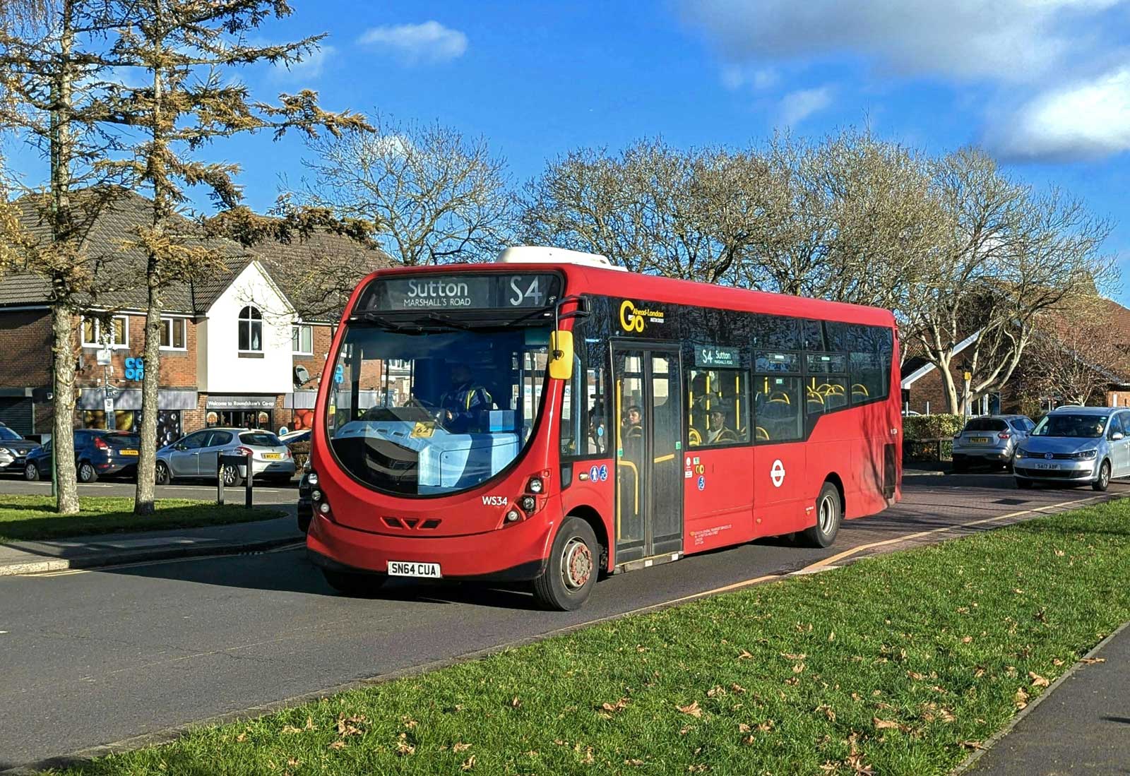
| 29.11.25 | C181+ |
7sd |
6sd |
6sd |
 |
New contract commenced with Go-Ahead operating from Croydon Garage |
SUTTON - WADDON MARSH Tram Stop
New contract commenced with Go-Ahead ( Croydon C )
 |
|
WS34 at Roundshaw Phoenix Centre © Ryan Fielding |
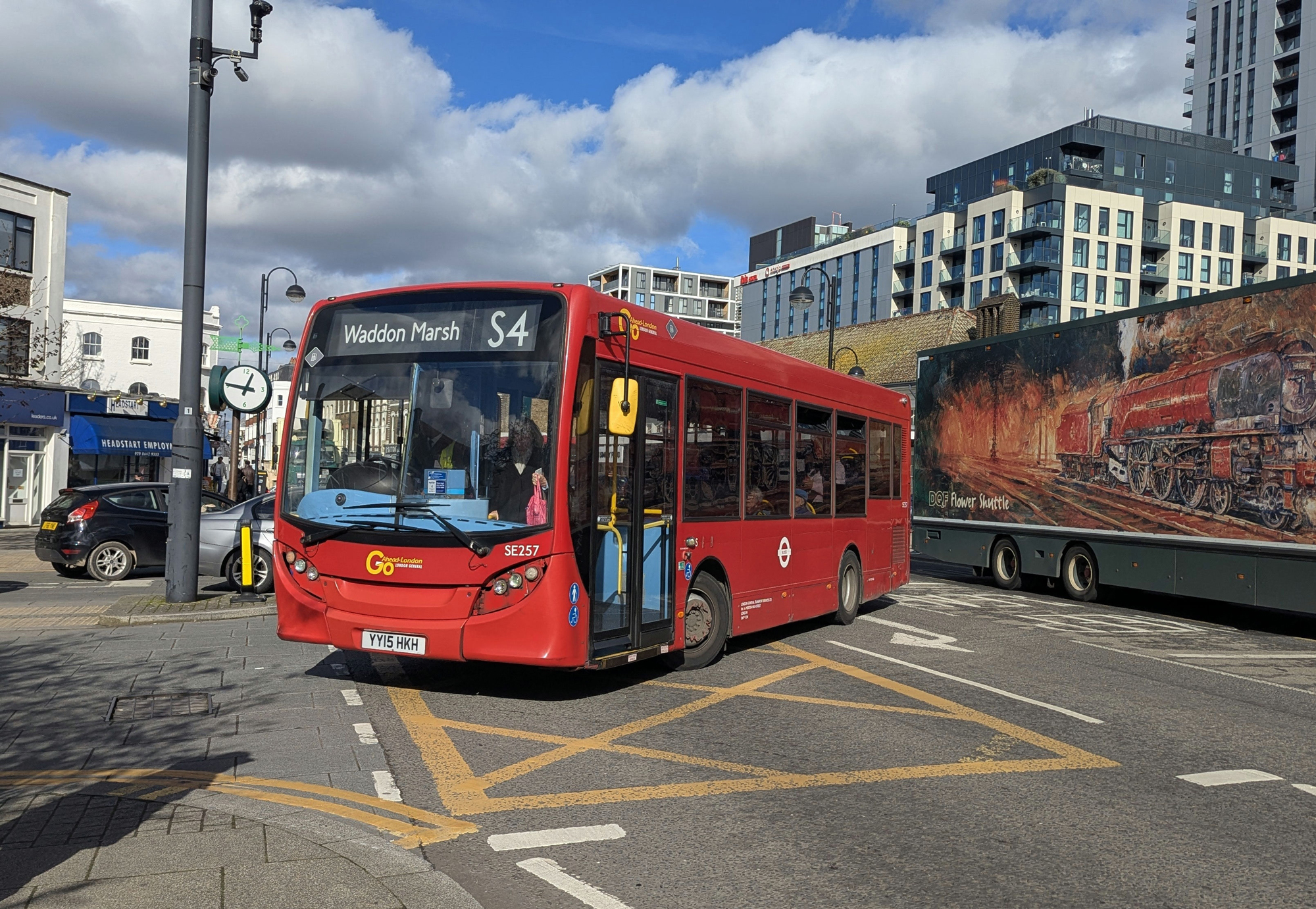
SE257 Sutton Station © Ryan Fielding |
Garages
C Croydon
Changeover at Beddington Cross
Changeover point Wallington Station
BC Beddington Cross
Changeover point Beddington Library
![]()